Urban mobility is at a critical juncture. As cities grow and populations increase, the need for efficient, sustainable transportation has never been more pressing. Optimizing city journeys not only reduces travel times but also plays a crucial role in cutting emissions and improving quality of life. From innovative infrastructure designs to cutting-edge technology solutions, urban planners and transportation experts are revolutionizing how we move through our cities.
Urban traffic flow optimization techniques
Traffic congestion is more than just a daily frustration for commuters; it’s a significant drain on economic productivity and a major contributor to urban air pollution. Addressing this challenge requires a multifaceted approach that leverages both traditional infrastructure improvements and modern technological solutions.
One of the most promising developments in urban traffic management is the implementation of adaptive traffic signal control systems. These systems use real-time data from sensors and cameras to adjust signal timing based on current traffic conditions. By dynamically responding to traffic flow, these systems can reduce wait times at intersections by up to 40% and decrease overall travel times by 25%.
Another innovative approach is the use of traffic flow prediction models. By analyzing historical data and current trends, these models can forecast congestion hotspots before they occur, allowing traffic managers to take preemptive action. This proactive approach to traffic management has been shown to reduce travel times by up to 15% in pilot studies.
Sustainable transportation infrastructure design
Creating sustainable transportation infrastructure is fundamental to optimizing city journeys. This involves redesigning urban spaces to prioritize efficient, low-emission modes of transport while discouraging private car use in city centers.
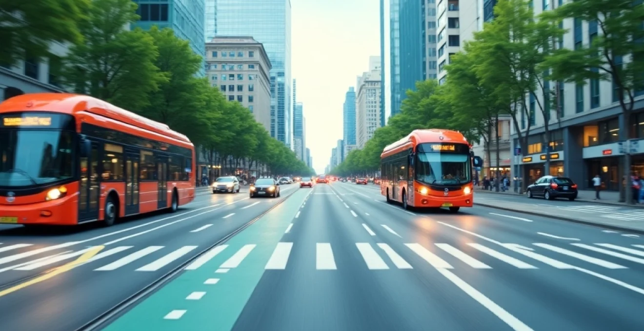
Dedicated Bus Rapid Transit (BRT) lanes implementation
Bus Rapid Transit systems have emerged as a cost-effective solution for improving public transportation in urban areas. By dedicating lanes exclusively to buses, cities can significantly increase the speed and reliability of bus services. For example, the TransMilenio BRT system in Bogotá, Colombia, has reduced travel times by up to 50% and carries over 2.4 million passengers daily.
Cycle superhighways: Copenhagen model adaptation
Copenhagen’s cycle superhighways serve as a gold standard for bicycle infrastructure. These wide, protected bike lanes connect suburban areas to the city center, encouraging cycling for longer commutes. The network has contributed to 41% of all trips to work or education in Copenhagen being made by bicycle, significantly reducing traffic congestion and emissions.
Smart traffic light systems with AI-powered synchronization
Artificial Intelligence is revolutionizing traffic management through smart traffic light systems. These systems use machine learning algorithms to optimize traffic flow across entire networks of intersections. In Pittsburgh, the implementation of AI-powered traffic lights reduced travel times by 25% and idling time by over 40%.
Congestion pricing zones
London’s Ultra Low Emission Zone (ULEZ) demonstrates the effectiveness of congestion pricing in reducing traffic and improving air quality. Since its introduction, the ULEZ has led to a 44% reduction in roadside nitrogen dioxide levels and a 13% decrease in carbon dioxide emissions within the zone.
Congestion pricing is not just about reducing traffic; it’s about creating a more livable city for all residents.
Multimodal integration for seamless city mobility
The future of urban mobility lies in seamless integration of various transportation modes. This approach allows citizens to effortlessly combine different types of transport for optimal journey efficiency.
Maas (Mobility as a Service) platforms: Helsinki’s whim app analysis
Helsinki’s Whim app is pioneering the Mobility as a Service (MaaS) concept. This platform allows users to plan, book, and pay for various modes of transport through a single interface. Since its launch, Whim has facilitated over 24 million trips, with 63% of users reporting that they use private cars less frequently.
Park-and-ride facilities at transit hubs
Park-and-ride facilities encourage commuters to leave their cars at the city’s periphery and use public transport for the final leg of their journey. In Munich, Germany, park-and-ride facilities have reduced inner-city traffic by an estimated 22,000 cars per day.
Bike-share and E-Scooter integration with public transit
Integrating bike-share and e-scooter systems with public transit provides a solution for the “last mile” problem. In Barcelona, the integration of the Bicing bike-share system with public transport has led to a 30% increase in cycling trips and a 10% reduction in car journeys.
Data-driven urban planning for efficient travel
The power of big data is transforming urban planning, enabling cities to make more informed decisions about transportation infrastructure and services.
Predictive analytics for proactive congestion management
Predictive analytics tools use historical data and real-time inputs to forecast traffic patterns. Cities like Singapore use these tools to adjust traffic signal timings, deploy traffic police, and send alerts to commuters, reducing congestion by up to 15% during peak hours.
Digital twin technology for urban mobility simulation
Digital twin technology creates virtual replicas of transportation networks, allowing planners to simulate and test various scenarios. Stockholm’s digital twin has been instrumental in optimizing public transport routes, resulting in a 7% reduction in waiting times for passengers.
Data is the new infrastructure. It’s as critical to urban mobility as roads and railways.
Green corridor development and low emission zones
Creating green corridors and low emission zones is crucial for promoting sustainable urban mobility and improving air quality in cities.
Electric vehicle charging infrastructure expansion
Expanding electric vehicle (EV) charging infrastructure is essential for encouraging EV adoption. Amsterdam’s strategy of installing public charging points based on resident requests has led to over 5,000 charging points citywide, with EV ownership growing by 73% annually.
Urban greenways and pedestrianization projects
Urban greenways and pedestrianization projects not only promote walking and cycling but also improve air quality and urban aesthetics. New York City’s High Line park, built on a former elevated railway, attracts over 8 million visitors annually and has spurred significant economic development in surrounding areas.
Last-mile connectivity solutions: Singapore’s LRT system
Singapore’s Light Rail Transit (LRT) system exemplifies effective last-mile connectivity. Serving as a feeder service to the main Mass Rapid Transit (MRT) lines, the LRT system has increased public transport usage by 15% in areas it serves.
Optimizing city journeys for faster, greener travel is a complex challenge that requires a holistic approach. By implementing a combination of smart infrastructure, data-driven planning, and integrated mobility solutions, cities can significantly improve travel efficiency while reducing their environmental impact. As urban populations continue to grow, the importance of these strategies will only increase, shaping the future of sustainable urban mobility.