As cities continue to expand and populations grow, the challenges of managing urban mobility become increasingly complex. Efficient urban flow management is crucial for reducing congestion, improving air quality, and enhancing the overall quality of life for city dwellers. By leveraging advanced technologies and implementing innovative strategies, urban planners and transportation experts are revolutionizing the way we approach traffic and public transport optimization.
Intelligent traffic signal control systems
One of the most effective tools in urban flow management is the implementation of intelligent traffic signal control systems. These advanced systems use real-time data and sophisticated algorithms to optimize traffic flow at intersections, reducing congestion and improving overall mobility. By dynamically adjusting signal timings based on current traffic conditions, these systems can significantly reduce wait times and improve the efficiency of urban road networks.
Intelligent traffic signal control systems typically incorporate a variety of sensors and cameras to monitor traffic flow and vehicle presence. This data is then processed by centralized control systems that use adaptive algorithms to make split-second decisions about signal timings. The result is a more responsive and efficient traffic management system that can adapt to changing conditions throughout the day.
One of the key benefits of intelligent traffic signal control systems is their ability to prioritize certain types of vehicles, such as emergency responders or public transit vehicles. This feature, known as signal preemption , allows these high-priority vehicles to move through intersections more quickly, improving response times and overall service reliability.
Urban data analytics for traffic optimization
The rise of big data and advanced analytics has revolutionized urban flow management. By collecting and analyzing vast amounts of data from various sources, city planners and traffic engineers can gain unprecedented insights into traffic patterns, enabling them to make more informed decisions about infrastructure improvements and policy changes.
Real-time traffic flow monitoring with IoT sensors
The Internet of Things (IoT) has enabled the deployment of a wide array of sensors throughout urban environments. These sensors can collect real-time data on traffic flow, vehicle speeds, and congestion levels. By integrating this data into centralized management systems, traffic operators can quickly identify and respond to emerging issues, such as accidents or unusual congestion.
IoT sensors can also be used to monitor parking availability, air quality, and even pedestrian movements. This comprehensive approach to data collection allows for a more holistic understanding of urban mobility challenges and opportunities.
Predictive modeling using machine learning algorithms
Machine learning algorithms are increasingly being used to analyze historical traffic data and predict future patterns. These predictive models can help traffic managers anticipate congestion hotspots and proactively implement mitigation strategies. For example, signal timings might be adjusted in advance of an expected surge in traffic, or variable message signs could be used to redirect drivers to less congested routes.
The power of machine learning in traffic optimization lies in its ability to identify complex patterns that might not be immediately apparent to human analysts. As these algorithms become more sophisticated, they have the potential to revolutionize urban flow management by providing increasingly accurate and actionable predictions.
Integration of historical data and weather patterns
Weather conditions can have a significant impact on traffic patterns and congestion levels. By integrating historical weather data with traffic data, urban planners can develop more accurate models for predicting traffic flow under various weather scenarios. This information can be used to implement targeted strategies for managing traffic during adverse weather conditions, such as adjusting signal timings or deploying additional resources to key areas.
Furthermore, the integration of weather data can help improve the accuracy of long-term traffic forecasts, enabling better planning for seasonal variations in traffic patterns.
Crowd-sourced traffic information: Waze and Google Maps
Crowd-sourced traffic information platforms like Waze and Google Maps have become invaluable tools for both drivers and traffic managers. These platforms aggregate data from millions of users to provide real-time information on traffic conditions, accidents, and other incidents that might affect travel times.
Many cities have formed partnerships with these platforms to share data and improve overall traffic management. By incorporating crowd-sourced data into their decision-making processes, traffic managers can gain a more comprehensive understanding of real-time conditions and respond more effectively to emerging issues.
Public transport prioritization strategies
Efficient public transportation is crucial for reducing congestion and improving urban mobility. Many cities are implementing strategies to prioritize public transport vehicles, ensuring they can move through traffic more quickly and reliably.
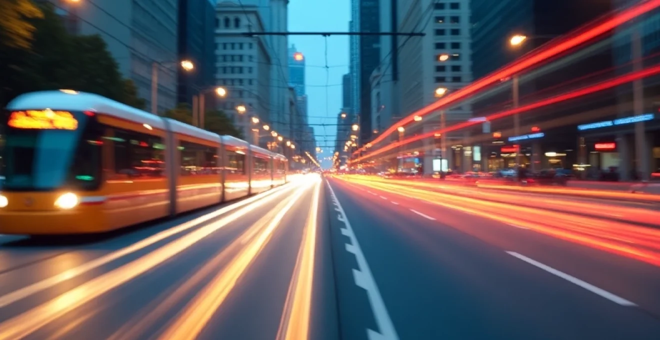
Tram and light rail integration in mixed traffic
Integrating trams and light rail systems into mixed traffic environments presents unique challenges for urban flow management. To ensure the efficiency of these systems, many cities are implementing dedicated lanes and signal priority systems for trams and light rail vehicles.
Transit signal priority (TSP) systems use sensors to detect approaching trams or light rail vehicles and adjust signal timings to minimize their wait times at intersections. This can significantly improve the reliability and speed of these services, making them more attractive to commuters.
Multimodal transport hubs: seamless transfers
Multimodal transport hubs are designed to facilitate seamless transfers between different modes of transportation, such as buses, trains, and bicycles. These hubs play a crucial role in optimizing urban flow by reducing transfer times and improving the overall efficiency of the public transport network.
Key features of effective multimodal transport hubs include:
- Real-time information displays for all modes of transport
- Integrated ticketing systems
- Secure bicycle parking facilities
- Convenient pedestrian access
- Accessibility features for passengers with mobility challenges
By creating well-designed multimodal hubs, cities can encourage more people to use public transportation, reducing overall congestion and improving urban mobility.
Smart parking solutions for urban congestion reduction
Parking management plays a crucial role in urban flow optimization. Inefficient parking systems can lead to increased congestion as drivers circle blocks looking for available spaces. Smart parking solutions leverage technology to streamline the parking process and reduce unnecessary traffic.
Advanced parking management systems typically incorporate the following features:
- Real-time occupancy monitoring using sensors
- Mobile apps for finding and reserving parking spaces
- Dynamic pricing based on demand
- Integration with navigation systems for seamless guidance
By implementing smart parking solutions, cities can reduce the time drivers spend searching for parking, leading to decreased congestion and improved traffic flow. Additionally, these systems can provide valuable data on parking patterns, helping urban planners make more informed decisions about future infrastructure development.
Congestion pricing and dynamic toll systems
Congestion pricing and dynamic toll systems are powerful tools for managing traffic flow in urban areas. These strategies use economic incentives to encourage drivers to modify their behavior, either by choosing alternative routes, traveling at different times, or opting for public transportation.
London’s Congestion Charge Zone implementation
London’s Congestion Charge Zone, implemented in 2003, is one of the most well-known examples of congestion pricing. Drivers entering the central London zone during peak hours are required to pay a daily fee. This system has successfully reduced traffic volumes and improved air quality in the city center.
Key outcomes of London’s Congestion Charge Zone include:
- A 15% reduction in traffic volumes within the zone
- Improved bus reliability and reduced journey times
- Increased cycling and walking in the city center
- Significant reductions in vehicle emissions
Singapore’s Electronic Road Pricing (ERP) system
Singapore’s Electronic Road Pricing (ERP) system is a sophisticated dynamic toll system that adjusts pricing based on real-time traffic conditions. Implemented in 1998, the ERP system uses a network of gantries equipped with sensors to detect vehicles and automatically deduct tolls from prepaid cards.
The ERP system’s dynamic pricing model encourages drivers to adjust their travel patterns to avoid high-cost periods, leading to more evenly distributed traffic flow throughout the day. This approach has been highly effective in managing congestion in Singapore’s dense urban environment.
New York City’s proposed central business district tolling program
New York City is currently in the process of implementing a congestion pricing system for its central business district. The proposed program aims to reduce traffic congestion, improve air quality, and generate revenue for public transportation improvements.
Key features of the proposed system include:
- A tolling zone encompassing Manhattan south of 60th Street
- Variable pricing based on time of day and vehicle type
- Exemptions for emergency vehicles and vehicles transporting people with disabilities
- Revenue dedicated to funding public transit improvements
While the implementation of this system has faced some challenges and delays, it represents a significant step forward in urban flow management for one of the world’s most congested cities.
Sustainable Urban Mobility Plans (SUMPs) and long-term strategy
Effective urban flow management requires a comprehensive, long-term approach that considers all aspects of mobility and urban development. Sustainable Urban Mobility Plans (SUMPs) provide a framework for cities to develop integrated strategies that address both current and future mobility challenges.
Key elements of a successful SUMP include:
- A clear vision for sustainable urban mobility
- Integration of all transport modes and services
- Stakeholder engagement and public participation
- Measurable targets and regular monitoring
- Consideration of land use and urban development patterns
By developing and implementing comprehensive SUMPs, cities can create more livable, efficient, and sustainable urban environments. These plans typically focus on reducing dependence on private vehicles, promoting active transportation modes such as walking and cycling, and improving the efficiency and attractiveness of public transportation systems.
Long-term strategies for urban flow management often include ambitious goals such as achieving carbon neutrality in the transport sector, implementing extensive networks of dedicated bicycle lanes, or transitioning to fully electric public transport fleets. While these goals may seem challenging, they provide a clear direction for future development and help guide decision-making at all levels of urban planning and management.
As cities continue to grow and evolve, the importance of effective urban flow management will only increase. By leveraging advanced technologies, implementing innovative strategies, and adopting comprehensive, long-term planning approaches, urban areas can create more efficient, sustainable, and livable environments for their residents.